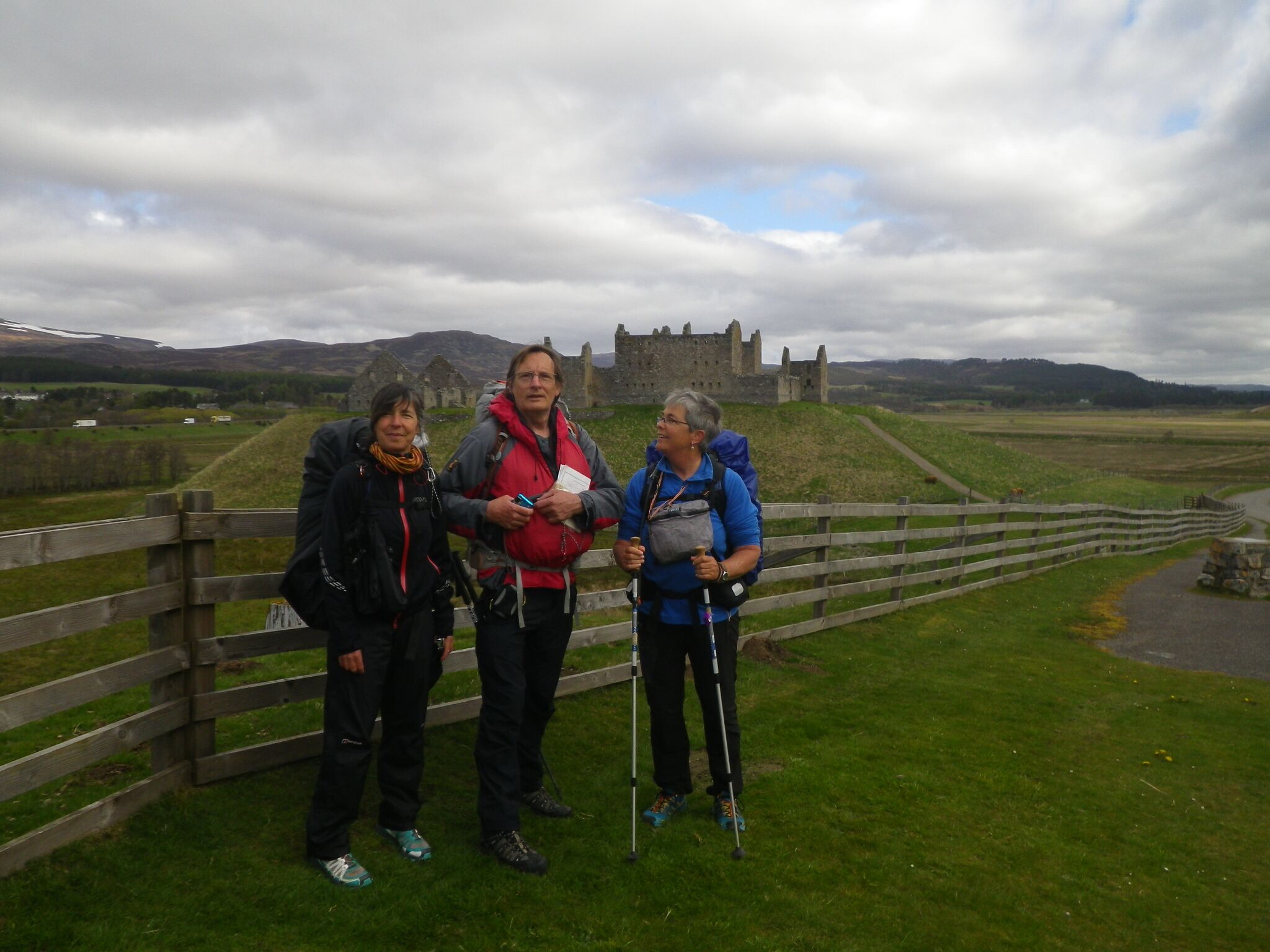
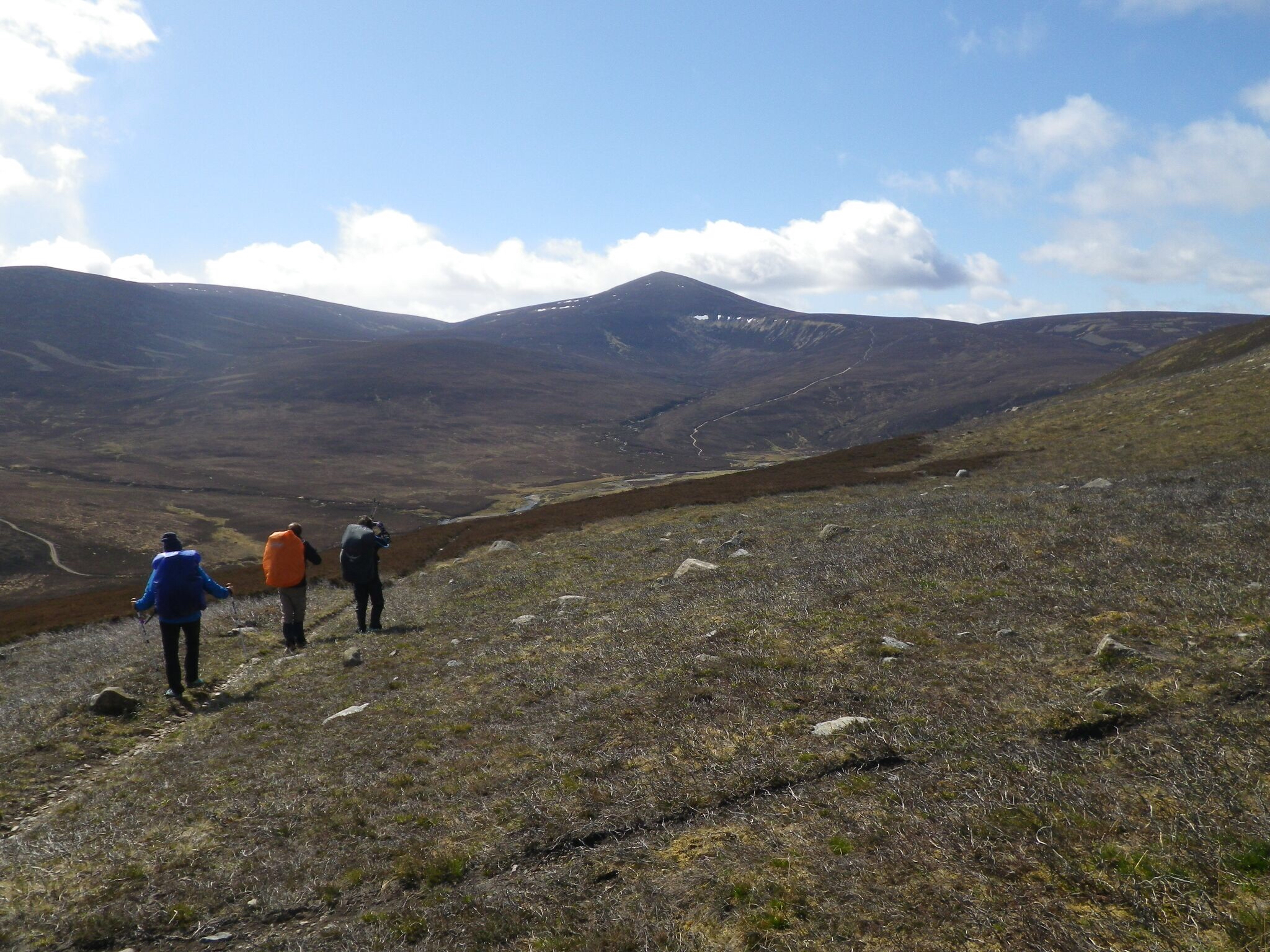
Cast of Characters (Apologies for any mis-spelling):
Day 1 Derek; Ellie and Barbara and Dave Hewitt
Day 2 Dave Hewitt and Rob (Raconteur, wit and former English Teacher)
Day 3 Mick and Gayle plus Colin
Day 4 Just me
Days 5 and 6 Rob and the Dutch Damsels - Marianne and Thilou
Day 7 Marianne; Thilou and Rod
Day 8 and 9 Marianne ; Thilou; Cardiff Chris and Linlithgow Paul
Day 1 Friday 8 May; Shiel Bridge to Alltbeithe (Glen Quoich)17km; 835m ascent; 641 m descent ; Weather excellent all day – bright sunshine and some warmth in the day
A great advantage to living in Insch is that unlike most Challengers I did not have to spend the day (or more) before the Challenge, travelling to my start point. Instead I could sleep in my own bed and get the 06:50 train from Insch to Inverness and after a short wait (which included a sausage butty) at Inverness Bus station I was on a bus (from which I spotted my 1st and only Eagle on this crossing) that deposited me at the Kintail Lodge Hotel at 1100. A quick trip to the loo and I was signed out and on my way in the 2015 TGO Challenge just 3 hours behind most of the Shiel Bridge starters. So this year’s start was leisurely though missing in the camaraderie that can entail a Thursday arrival at the start point. Within ½ a mile I heard the rising crescendo of jet engines and then came the unmistakeable shape of an RAF Tornado coming down the Valley at 250ft and doing something like 500 knots. As he passed II was nearly deafened by the sound but could clearly see the pilot and navigator – it was after all no more than 100m from me.
On the bus journey it was clear that the recent poor weather herein Scotland had left a substantial amount of new snow on the Munros of the South Glenshiel Ridge and on Sgurr na Sgine . Having chosen not to bring Ice Axe or Crampons I immediately decided that Sgurr na Sgine could wait for a later trip and decided instead to head along General Wades Military Road to the South Glenshiel ridge here it would be possible to get high safely and to assess the safety of these Munros with an option to pass over the col (Bealach Dubh Leac ) into Glen Quoich if the hills looked too snowy.

Starting Point - Shiel Bridge
As I crossed Allt Mhalagan I met up with Derek, a gentleman of more advanced years than myself but who was going like a train! Derek, in preparation for an Alpine trip was doing the 1st 3 days of the challenge with Elli and Babs (they were on the whole challenge). It was obvious that these 3 were very experienced hill-goers and were equipped for snow and ice work. They planned to camp on the Ridge and this would not be the 1st time they had done so. I went ahead for a while but Derek and co caught up as I was having lunch at about 500m. I’m glad they did as for the 2nd time in as many years I was struggling to find the Old Military Road once it turned up towards the Bealach Dubh Leac. (in the past I have made the mistakes of following the wrong (right hand) branch of the valley leaving a steep and exposed scramble to get back on track).

Looking into Glen Quoich from the Bealach
Derek, Elli and Babs all knew where the correct track was and we were soon on our way along a series of switchbacks that led easily to the Bealach. As we neared the top we met a group of walkers on their way down who had turned back because of snow conditions on the ridge. This is where I therefore left the others who carried on to camp high whilst I went over the Bealach. The initial descent into Glenquioch is steep and there was no sign whatsoever of the path that shown on the map. Nevertheless heading down and towards the river you inevitably end up in the right place.

Tree Stumps Uncovered
The last few km of the day was covered by walking on a Land rover track along the northern bank of the river Quoich. For some reason I became fixated with the idea to reach Alltbeithe before setting up camp so I ignored some excellent campsites along the river bank only to find that the area around Allltbeithe was an industrial site where a large plastic ( I presume for water) pipeline was being installed. So in the end my campsite was neither that remote (cranes, bulldozers and disturbed ground aplenty) nor pleasant given the churned up ground around . Furthermore, by ignoring the earlier and better sites along the river it was 7pm before I pitched tent for the day.
This was the 1st time I had pitched the Mini-Peak in anger and it was a pleasant surprise to find it such an easy task. The tent was my favourite piece of kit on this year’s challenge though it took me a couple of days to figure out how to get a nice tight pitch. Witin 30 mins I had scoffed a Mountain Warehouse Chicken Tikka Meal and had a Coffee. Throughout this Challenge I would eat hot food only after pitching for the day (unless there was a café or restaurant nearby) and drink one hot drink per day. By this means I could save weight in fuel and used less than one small gas canister over the whole 10 days
Day 2 Saturday 9 May; Alltbeithe to a surprisingly comfortable camp by a road bridge over the River Loyne. Again the Weather was excellent, warm sunny and clear. 21km; 757m ascent; 806m descent
I woke early, ate my breakfast flapjack, drank water and was packed and on the move by 0730 in glorious sunshine. My plan was to walk east from Alltbeithe but I had not really planned a good end point for the day. There was an obvious track along the North side of the River Loyne to follow. After 30 minutes of walking I looked behind and saw a couple of figures coming along the path. 1st of these was Dave Hewitt and just following was Rob Jones. Dave was on his way to the Allt Beithe Youth Hostel in Glen Affric and Rob, who I was to walk with again later in the week, was planning on getting up Craig a Mhaim. We walked together for the next hour before Rob started upwards whilst Dave and I turned North to get a wonderful view of Sgurr nan Ceathreamnan over the An Caorainn Mor.

Dave Hewitt coming up the path
Here, Dave continued north towards Cluanie. I turned right to climb the Corbett Beinn Loinne. The approach was across some boggy though not too broken ground and it was annoying to find a couple of false summits before reaching the trig point which to my surprise turned out to be a cylindrical affair. I now thought I had earned lunch so sat down and ate a choccy bar and also decided to massage my feet . My right small toe was feeling a little bruised and the sole a little tired (this little toe would not bother me again on the walk although the left pinky would do!

View of Sgurr nan Ceathreamnan
The west summit at 789 metres is the Corbett although the top 2km to the east is labelled as Beinn Loinne on the OS 1:50000 sheet. From the summit I picked a route off the hill using the Allt Coire na Creadha as a handrail until reaching the forestry track at the bottom of Meall Odhar. At 3 O’clock I found a wonderful sheltered campsite by the river but, not learning the lesson from the previous day, decided that it was too early to camp so continued down. Being a berk I continued to ignore good campsites by the river until it was too late and I was on the forestry track leading down to the A87. It was now 5pm and I was on an A road with no obvious campsite and more to the point I was knackered.

A scout to the north found no good sites so I decided to look at my map and noticed the River Loyne on the east side of the A87. So I had a water source, what I needed now was a flat space so heading south I was scouting avidly until I found a bridge over the river to the east of which it was possible to pitch a tent about 30m from the road and at least slightly hidden by a few trees. This did not look ideal but I was too tired to care. In fact this was to be one of the most peaceful sites on the trip despite the nearby road. As the sun was getting lower I fed myself with Mountain Warehouse Salmon and Potato with Dill, drank a coffee and sat out in the warm evening air until retiring at 8pm.

Roadside Campsite

View of the road from my tent
Day 3 Sunday 10 May; A87 to Fort Augustus. Early rain followed by rain and mist for the rest of the day with some rain thrown in. Did I say it rained? 21km; 512m ascent; 703m descent
I woke later to the sound of rain on the tent. At this stage I hadn’t quite sorted my packing routine so didn’t get everything packed until about 8 when looking up from my pack I saw Mick coming along the path I had followed the night before. Assuming I too was on the Challenge, Micks 1st words were ‘Are you wearing Innov8s?’ my response in the affirmative led to the follow on ‘WHAT SIZE?’. Mick had been following my route yesterday and unlike me he had picked a nice campsite by the river but had noticed my tracks ahead of him to be astounded by the 13 ½ size of shoes I was wearing (Personally I think anything under a size 12 is a ladies size).
For the rest of the day I had the pleasure of walking with Mick, whom I recognised from his wife, Gayle’s blog (much better than mine you can find it here: http://gayleybird.blogspot.co.uk). Like me, Mick, had been in the RAF but unlike Mick had figured out how to retire early and enjoy an awful lot more time in the hills than me. It was great to hear of Mick and Gayle’s trips along and across Britain and on the PCT so there was never a dull moment today despite the very grey views through cloud and mist as we followed forestry tracks all day towards Fort Augustus.

Fort Augustus
For the 1st time I noticed blisters forming on my feet and I put these down to the inability of my Roclites to keep my feet dry or to dry out (despite Andy Howell’s promises!). The views were never great as we walked the rain and mist past the windfarms of the Beinneun Forest. As there was not an awfl lot of up and down today we ended up at Fort Augustus reasonably early and I had the tent up by 1430. More importantly, Gayle, who was spending a week climbing Marilyns in the area before spending the 2nd week of the Challenge at Challenge control, was meeting Mick at the campsite in their camper van. It was great to get an invite across and to taste wonderful home-made ginger and chocolate flapjacks and Tea Cake and with Gayle refilling my cup with tea it was a fantastic end to the days walk. Also at the Camper Van was Colin Ibbotson who was halfway through his Scotland National Trail Walk. Colin is especially well known in lightweight backpacking circles so it was good to get some tips though too late to find ot that I should have put Vaseline on my feet to prevent blisters!

At Ft Aggy campsite
After cakes and Tea it was time to put up the tent. As my feet were sore I thought it would be a good idea to go barefoot on the damp grass. Turned out this wasn’t a good idea at all as I promptly stood on a tent peg and put another hole in my sole! After a short run into the village to collect food for the next few days I decided that dinner should be at the campsite so I teamed up with Colin for Dinner and a couple of pints. Food on the site was excellent although I was envious of Colin’s choice of Fish and Chips which was enormous.
Day 4 Monday 11 May; Ft Augustus to Garva Bridge via the Corrieyairack Pass; 26km; 928m ascent; 777m descent
What a fine morning it was looking to be. The sun was up, the rain had stopped and it was reasonably warm, sadly it was not to last. Setting off alone out of Fort Augustus I wandered past the old burial ground and followed the old military road into the Corrieyairack. Fortunately there are now boulders placed at the start of General Wade’s masterpiece to prevent 4X4s churning up the road which has apparently been a problem in the past. Not so now instead there are bulldozers and cranes pulling down old Pylons and putting up the new massive Beauly – Denny Pylons in their place.
It started out fine
This industrial work wasn’t apparent in the lower parts of the road along Glen Tarff and here the walking was pleasant. As I reached the Bothy at Blackburn I was able to step across the burn with ease. It turns out that those coming behind me a couple of hours later would struggle to find a safe crossing point as this would become a raging torrent once the heavens opened 20 minutes after I passed.
So as I rounded Carn Bad na Circe the rain started and as I got higher the wind increased such that once on top of the pass I was being blown sideways. The views were very poor in the howling wind and rain and which made the industrial activity seem even more depressing. Although my waterproofs kept the rain out it was something of a struggle to the summit at which point water somehow managed to breach the GoreTex defences of my trousers just to add to the misery. And then joy of joys as I crested the summit the rain stopped and the wind died down and views opened up ahead. I put this down to some sort of adiabatic effect and assuming that therefore the wind and rain were being held on the western side of the pass I took the opportunity to remove my waterproof trousers in order to let my trousers dry out.

Of course my meteorological expertise was faulty and within 15 minutes it was dinging down with a mix of hail and snow! As I was descending out of cloud I at least had views towards the east. My feet were soaking anyway so I simply waded through a number of streams crossing the path downwards. There was a ford marked at one point but this seemed a little too deep to wade as my walking pole failed to find a bottom when I tested it. At this point I detoured south to fond a crossing about 500m south of the so-called ford.
Twice today I would miss out on the kindness of others as it seemed I was coming in too early. Firstly at Melgarve I passed a chap in his Romahome he waved as I passed. Only later did I find out that he was looking for Challengers to give free hot chocolate to (he had multiple challenges under his belt but this year wasn’t partaking) but that I had arrived before he was ready to serve. As I arrived at Garva bridge I could see another tent on the flat area to the east side of the Spey so pitched mine just up from that. With the wind still strong I dived in and cooked an early dinner under cover at 3:30. What I didn’t know was that there was no a chap with an SNP hat on now camped on the western side of the bridge handing out whisky to all those who passed (he was obviously celebrating the recent election success).
I was a little concerned sitting in my tent that the wind would batter it down as I was still reasonably exposed but now the sun was out again I was hopeful that it would die down. It was now that I met Marianne and Thilou for the 1st time when they pitched up a couple of hours after me. Sensibly they decided that my spot was far too windy and were off to camp in a more sheltered spot near some trees. I did consider following them but couldn’t be bothered moving. Instead I would have a disturbed night as the wind would cause my not particularly well pitched tent to flap wildly for most of the night
Day 5 Tuesday 12 May; Garva Bridge to Newtonmore; 23 km; 177ascent; 232 descent
I woke early at 0130 in the howling gale so went to sleep again until 0200 then 0300 then 0430, you get the picture. Finally at 0430 with the wind still battering the tent I decided to get up and get walking. Just as I finished dressing inside the tent (this Luxe Mini Peak was excellent for space) the wind seemed to die down so lying back on my sleeping mayt I decided that I would wait for 10 minutes to see if the wind had abated temporarily or permanently. 3 hours later I woke again for my latest start so far o the challenge. By the time I eventually got moving every other tent except one (which turned out to be that of Rob Jones) had gone.
The weather was still duff with low cloud in every direction so I decided to forego the Geall Charn and the other Monadh Liath Munroes and go for my FWA – Laggan. The only problem with this was that Laggan was only 11 km away and I would be finished before lunch so I ended up deciding to go for Newtonmore. I could see a couple of walkers (Marianne and Thilou) about a km ahead of me as I started walking.

Garva Bridge in the morning

Towards Laggan
The road to Laggan is paved but also ancient as it follows General Wade’s route for the most part. Although tarmac it wasn;t particularly hard on the feet and even in the mist this walk seemed quite pleaseant. Just before the Spey Dam I passed Marianne and Thilou (at this stage none of us had been introduced we simply said good morning) who had stopped for a break. I reached Laggan just after 11 and went to find somewhere to dress my feet. Stopping at the Tourist Info board outside a B&B I sat down and started applying compeed when a voice said good morning it was Rob, whom I had previously spoken to on Saturday. Rob had caught up with the girls and had walked into Laggan with them (somewhat more sociable than me!). I resolved to meet them all at the Laggan Store (just opposite the Laggan Store as it turned out) where we could get a cuppa and some cake.

There were 2 advantages to the Café that is currently acting as Laggan’s store . Firstly tea and Cakes and secondly it was just down form the public loos. I had some fine refreshments at the same time as introducing myself to Marianne and Thilou. We discovered from te shop owner that floods over the winter had damaged Laggan Bridge which was consequently closed for repairs. This meant that the A86 to Newtonmore (approx. 10km away) was hardly in use and would be safe for walkers to use. That would be our route in the afternoon. The walk then was pleasant as we chatted although Thilou had a sore hip (so she said – by Sunday she was almost running up Mt Keen!) and my feet were feeing the effects of the tarmac by the end of the day.

We arrived at Newtonmore just before 3 and were pleasantly surprised to find a pub, the Glen Hotel, right where we needed it. After a pint or 3 Rob disappeared to the campsite to where he had had a food parcel delivered and I followed Marianne and Thilou to the Newtonmore Hostel run by Sue and Ali (the Organisers of the 2015 Challenge). I was able to get the last space available plus a cup of coffee and another piece of cake! That night we all met up at the Pub for a fine bar meal before retiring and agreeing to meet at 0830 in the morning as we were all heading towards Glen Feshie
Day 6 Wednesday 13 May; Newtonmore to Glen Feshie; 25km; 460 ascent; 280 descent
I was up and ready in plenty of time for our rendezvous so popped along to the Co-Op to buy some mini pork pies for lunch (I needn’t have bothered as we would pass the shop in any case en route to Kingussie. At 0830 Rob, Marianne, Thilou and I set off on the short walk to Kingussie where we were told (erroneously as it turned out that no cafes were open before 10 so we missed our planned fry up for breakfast and trudged up the road to impressive ruins Ruthven Barracks.

Thilou; Rob and Marianne at Ruthven Barracks
These barracks were build on a natural mound and was burned by retreating Jacobites in the aftermath of Culloden in 1746. Although unoccupied for over 250 years they are remarkably well preserved and we took the opportunity to take pictures. From Ruthven we headed east trough woods and fields towards Glen Feshie. At 1300, we paused for lunch in the sun at the bridge over the Feshie just south of Achleum. Here Rob decided to pitch his tent early in order to take the opportunity to climb into the Cairngorms the following day.

Thilou in Glen Feshie
It had always been my plan to go through Glen Feshie so after lunch the rest of us crossed the bridge and headed south following the river. I had heard that Glen Feshie was special and I was not to be disappointed as this glen turned out to be truly scenic. In the now warm sunshine we wandered along through this lovely Glen as far as the bothy at Ruigh Aiteachain. As there was smoke emanating from the chimney we popped in to look around. The bothy contains 2 large rooms that are extremely clean and we noticed that the wood burner in the 2nd room was on with a large pot of water boiling. Here we met the estate Factor and also challenger Chris Leach who had decided to stay the night. As it was still only mid-afternoon we decided to go further down the Glen. Once again I missed out on a free whisky as I found out the next day that had the Factor was sharing his whisky with those challengers who camped in and around the bothy that night.

View South of the bothy
South of the bothy we were met with wonderful views as we continued on for another 4km. At one point we met up with Rod Howard who was trying to figure how best to cross the raging river. He almost convinced us to strip down for a full blown river crossing as the path did seem to peter out at this particular meander. At this point Thilou scouted to the left and found a path on the steep ground to the immediate North that took us comfortably around the bend. Rod came with us and it was only then that we found out that he wasn’t even planning to go the same way as us but was aiming to get to a couple of Munros to the south of the Glen. We had nearly got soaked unnecessarily. From this river bend it was only a short distance to a wonderful camp spot beside the river and under the shelter of an ancient Scots pine. At last I could stand in the river and cool my feet off – a wonderful feeling, before cooking dinner and turning in for the night once the heat of the day dissipated.

Wonderful Glen Feshie Campsite
Day 7 Thursday 14 May Glen Feshie to Tomnamoine (White Bridge); 19km; 227 m ascent; 220m descent
After a great night’s sleep and the usual flapjack breakfast, though now Marianne was around I was getting to try out some of the excellent nibbles she had brought along too, all four of us struck camp and continued down the Glen towards the watershed with Glen Geldy. Rod soon left us to cross the Feshie at a sensible place and to climb his Munros, whilst Marianne continued in the Glen. Once again we were enjoying glorious sunshine though the temperature first thing was nothing to shout about.

After a couple of hours, just after the scaffold bridge over the Eidart, Chris Leach caught up with us and after a short chat continued on his way. The scaffold bridge is an interesting structure. Whilst appearing temporary I am certain it has been around for several decades and is in good condition though it does carry a ‘use at your own risk’ sign – looks like the HSE cannot be escaped anywhere in modern Britain!

Gradually as you approach the watershed the more enclosed Glen Feshie opens out into the wide and much flatter Glen Geldy where even with the big Cairngorm hills just to the north one gets the feeling of being in a much flatter landscape. For a while we could still see Rod meandering up his Munros but for the most part we were treading carefully on the rough track to avoid getting our feet too wet in the occasional puddle or peat hag. For the most part however the going was good and we met a few mountain bikers making their way into the hills. For the 1st time since day 1 we also started to see a lot of Air Force activity as USAF F15s and RAF Typhoons flew over us on several occasions.

Scaffold Bridge over the Eidart
Just before lunch we met up with Paul Dudchenko. Paul joined us for lunch, which for me was an Ainsley Herriot soup for which Marianne kindly provided boiling water. Refreshed we carried on along a mostly flat path past the Dukes Chair and Cairn Geldie towards White Bridge which many people use as a camp site. The walk was easy and, with company, entertaining. On crossing the bridge we spotted an Adder lying on the road. This was the 1st I had ever seen. Paul thought it looked like its back had been run over by a vehicle and I thought it was just sunning itself. Somewhat unwisely we decided to see its reaction by poking it with a stick. Well it reacted and was certainly alive so we decided to leave it.

Nearing White Bridge
We had been told that although there was ample camping around White Bridge, that there was a better site about 1500m further along at the end of a small wood so this is where we headed. What we found, was indeed an excellent site. I later discovered that this place was Tomnamoine which is marked as an Ancient Township on 1:25000 maps though not noted on the 1:50 k that I had at the time. What we aso found was that Chris had arrived ahead of us and had the best spot!. Having said that the site offered plenty of good sites so we all pitched tents. Paul shot off for a refreshing swim in the Geldie whilst the rest of us sat around in the sun and prepared our respective dinners.

Tomnamoine campsite soiree
We had arrived at the site around 4 pm and for the next 5 hours we had a fine evening chatting and drinking Paul’s whisky at this fine site. The sun shone and it managed to burn my ears. Too hot in the sun I went to the shade where I was too cold and ended up back in the sun – much to the amusement of the others. Shortly after retiring for the night a SAR helicopter flew low over our heads though we never knew whether this was an exercise or a real call out. At around 10 , after a superb day and even better evening I nodded off.
Day 8 Friday 15 May Tomnamoine to Braemar 13km; 121m ascent 181m descent
Today would be a short day, a sort of rest day without actually taking a day. Once again the morning was sunny and now 5 of us (3 of whom were classed as solo walkers) struck camp for the short walk to the Linn of Dee and Mar Lodge where we knew there was Tea, Coffee and biscuits laid on. The walk through the woods form Linn of Dee to Mar Lodge on a fine sunny morning is hard to beat. Surrounded by ancient woodland the high hills are only partly obscured. The Scots Pine woodland really does look beautiful and full of life unlike the awful Sitka Spruce plantations sadly so common.

Looking back to the Cairngorms
Once again the RAF was out in force (it not yet being the Weekend). As Typhoons flew overhead we followed the signs to Mar Lodge that promised refreshments for Challengers. As there was a wedding on we were directed around the back of this fine NTS property to the stable block where it was a great pleasure to sit down and drink coffee for a good hour or so as we chatted to the Challengers who had already arrived, most of whom had done a more challenging route through the Cairngorms than we – though I am glad we took the route we had as it was wonderful.
After an hour or so we were ready to move on. To get to Braemar you need to go to cross the Dee and then walk along the road on the south of the river for around 4km. There is a route through woods but frankly I’m not sure it improves the walk in. it was still fine and sunny as we wandered towards Braemar and the time flew past. On arrival we made our way to the WONDERFUL ‘Old Bakery’ where for just £5 I had a massive ‘Challenge Burger’ and chips plus Tea and for another £2 a fine Bottle of Cairngorm Ale. I cannot recommend this place highly enough. We liked it so much we went back for dinner that night and for breakfast the following day.

The Old Bakery Braemar - Fantastic Welcome and Great Food. Go there!
By 1400 we were at the Braemar campsite and just as it started to rain the tents were up. I went to Braemar Mountain Sports to buy a new vest socks. From here I proceeded to the Post Office to post home my worn and dirty vests and socks home. The postmaster asked me what was in the parcel and of course I responded ‘clothing’ though I would have been more honest to have said ‘bio hazard’. On the way back to the camp I was pleased to meet up with Mick and Gayle again and was once again invited to the camper van which for some reason I failed to find! In fairness there were an awful lot of campers at the site.
With the main Challenge meeting point, the Fife Arms, undergoing a 2 year £2M upgrade we managed to find a different pub for a few pints and were joined later by Rod and Rob. We all though about the forecast for Saturday and with Gale force winds and poor weather expected I decided to take a low level route to Ballater rather than my planned route over Lochnagar and into Glen Clova. Marianne, Thilou, Paul and Chris decided on the same FWA so we agreed to meet for breakfast at the ‘Old Bakery’ which would be open from 0800.
Day 9 Saturday 16 May Braemar to Ballater 28km; 423m ascent; 553m descent
After breakfast we set out for Ballater along the main road. The route was Chris’s suggestion though I think Thilou blamed me. The road was a lot busier than I would have expected on a Saturday morning so it was a relief to reach the Invercauld Bridge and head into the woods of the Balmoral Estate. Despite the forecast the weather was fine at least at low level and the walk through the woods was very pleasant indeed. Certainly it was easier on my blistered feet than the road had been.
Chris seemed concerned about security surrounding Balmoral castle, or perhaps he was trying to wind up the girls. In any case we easily gained access to the castle grounds, without paying by approaching form the west along the Dee footpath. Obviously, without a ticket we couldn’t wander inside but we were able to go to the coffee shop that HM runs where I had a rather nice Jam Scone for lunch along with a fine Americano.
After a bit of a faff trying to find the correct way out of the Castle grounds we ended up on the B976 which takes the southern bank of the Dee, rather than the North bank route of the A93 to Ballater. With the A93 taking most traffic, the B road is very quiet indeed and although tarmac turned out to be quite pleasant to walk on. Just outside Balmoral we stopped for lunch (in addition to my earlier scone) on an old bridge connecting Easter Balmoral to Crathie.
The next 10k to Ballater was a gentle stroll along this relatively peaceful road in fine sunny weather. There were good views back to Lochnagar (not expected given the forecast) and we passed some very fine secluded houses along the road. Paul’s family were meeting him at Ballater campsite and with 3 km or so to go his walking pace picked up as he left the rest of us in his trail. It turned out that his family were walking towards us at the same time.
The campsite at Ballater is right by the River Dee and I was looking forward to re-aquainting myself with this small but lovely town. Sadly just days before, the old Railway Station which housed a fine museum had burned down. It was now a rather sad sight. On the plus side the old Co-op had closed to be replaced by a rather larger one. It was great to buy fresh fruit – something one often neglects on the trail.
After dinner, Chris, Thilou, Marianne and I found a fine Real Ale selling hotel and spent a couple of hours chatting over tomorrow’s planned route. Thilou was adamant that we wouldn’t use a road so the plan was to enter the Woods across the Dee and then find the Mounth track to Tarfside. Turned out to be an excellent plan.
Day 10 Sunday 17 May Ballater to Tarfside; 26km; 1154m ascent; 1147m descent
Another sunny day and after breakfast we were on the move. Thilou was in charge this morning so on crossing back south of the Dee we went into the woods immediately and up to a memorial cairn (actually a bloody big monument) to some local landowner gadgy I’ve never heard of – the hubris of Ozymandias:
I met a traveller from an antique land
Who said: "Two vast and trunkless legs of stone
Stand in the desert. Near them, on the sand,
Half sunk, a shattered visage lies, whose frown,
And wrinkled lip, and sneer of cold command,
Tell that its sculptor well those passions read
Which yet survive, stamped on these lifeless things,
The hand that mocked them and the heart that fed:
And on the pedestal these words appear:
'My name is Ozymandias, king of kings:
Look on my works, ye Mighty, and despair!'
Nothing beside remains. Round the decay
Of that colossal wreck, boundless and bare
The lone and level sands stretch far away.
After the philosophical reflection we continued uphill. Thilou showed no signs of her earlier hip injury as she was ahead of everyone all day. The day was cool but pleasantly sunny, although as we gained height the wind increased, and we had some great views back to the Cairngorm hills. The Mounth road was easily picked up (by us at least – Paul who started later having said goodbye to his family would make a mistake that cost him an hour or so). Our next target, Mount Keen was visible early on.

Looking back to Ballater
As we progressed towards the Water of Tanar, we had great views of Glen Tanar and then of Mount Keen itself. We found a couple of bike poorly hidden by the Shiel of Glentanar, obviously someone was on the hill having taken the quick way in along Glen Tanar. I had only ever climbed Mt Keen from Glen Mark so this approach from the North was new to me and I must say that I preferred it, it seemed more remote and also much more scenic. It was also steeper. From the shieling the path up the hill is clear, with the Mounth path veering off to the right – the old drovers preferring to go around rather than over obstacles.

Mt Keen from The Mounth Road
As we got higher we spread out, none of us could match Thilou for speed though Chris seemed pretty comfortable. I certainly was panting a bit. From the north Mt Keen has a series of false summits. Every time I thought I had reached the summit I found there was another ahead! I predicted we would be on top by 1200 when we were about ½ way up but in fact I didn’t make it for a further 15 minutes. As I got higher the wind from the west was terrific and it was sometimes a struggle to stay upright until on reaching the top it was possible to duck down behind the summit rocks and suddenly all was quiet. We sat in the lee of the summit rocks to lunch and enjoy the sunshine. Looking east, over my 2012 route to the Fetteresso, and my proposed route for tomorrow, I was appalled to see the massive Wind Farm that has since been constructed in the Fetteresso and what appeared to be bulldozed tracks all over these Eastern hills.

Yours Truly with Marianne and Thilou - Mt Keen
After 30 minutes or so on the top we started to cool down so commenced the descent into Glen Mark. The path downwards was not as eroded as on the Glen Tanar side and we found a steady stream of walkers heading up – one girl wearing wellies. The path descended steeply by the ladder burn but from here it was straightforward to reach the shieling at the head of the Glen which appeared to be occupied. The Queen’s well is a famous structure that we visited as we passed. It was erected to commemorate the visit of Queen Victoria and Prince Albert to Lord Dalhousie in 1861. The inscription on the well reads:
‘Her Majesty, Queen Victoria, and his Royal Highness the Prince Consort, visited this well and drank of its refreshing waters, on the 20th September, 1861, the year of Her Majesty's great sorrow.’
From the well it was downhill all the way to the road in Glen Lee where we wold do the only road walking of the day (around ½ a mile) though Chris thought we ought to go to Tarfside via the road , the rest of us insisted on following the path through fields that passes the Victorian folly on Hill of Rowan. Around 1530 we arrived at the St Drostan’s in Tarfside. Chris continued straight to the Green in the village which is the temporary challenge campsite. Thilou, Marianne and I went into the St Drostan’s.

Food and Beer (note cakes) on arrival at St Drostans
This was the 3rd time I had been here and I think the St Drostan’s Hostel and the welcome one gets there is THE highlight of the challenge. Member of the ‘Over The Hill Club’ including Anne and Alva (whom I had 1st met in 2011 at Gelder Shiel Bothy), Marion, Marie and Roger Smith thrust cakes, tea, bacon rolls and in my case cans of Boddingtons into our hands. A wonderful wonderful welcome indeed. We were asked if we would like to stay for dinner (we would) of Baked Potatoes and Chilli (great). Marianne and Thilou headed off to the campsite before dinner promising to return but I succumbed to the offer of a bed and shower at the Hostel. Around 1900 Paul turned up having followed, for the most part, our route from Ballater. I am a little ashamed to say that Paul led me astray and we spent a very pleasant evening after dinner drinking a pint or 5 of beer.
Day 11 Monday 18 May Tarfside to St Cyrus; 38km; 328m ascent; 463m descent

Paul with the Over The Hill Club at Breakfast
Despite a surfeit of Boddingtons, I slept well before waking at 0700 and having a fine breakfast bacon roll and coffee. Marianne, came along to say cheerio as she would stay in Tarfside to await the arrival of her friend Willem. I had really enjoyed the several days walking we had done together and had learned an awful lot from Marianne, particularly on how better to look after one’s feet, so I was glad she took the trouble to come along to St Drostan’s this morning.
In 2012 I had really enjoyed the 2 day walk from Tarfside, over Mount Battock and Clah na Ben and then through the Fetteresso. However, yesterday’s views of wind farms and tracks had depressed me somewhat about that route. So, wanting to keep my fine memories of 2012 intact, I changed my finish route and agreed to accompany Paul to St Cyrus. I am glad I decided on this for a number of reasons. Firstly, Paul was an engaging walking companion with some of the same idiosyncrasies as myself, including a hoarding habit when it comes to books and magazines. Secondly, although the day started fine and sunny, by 1000 it was raining and the cloud base was considerably below the height of Clach na Ben , let alone Mt Battock.

The route to St Cyrus from Tarfside is pretty straightforward although Paul and I made a mistake early on. We were told that only 1 of the bridges that cross the North Esk is now open to the public. Well Paul and I missed that one and went another km or so along the road. Mistaking the Milton Lodge bridge for the public bridge we sauntered across a well kept grass field before hearing ‘OI!’ . It wasn’t quite a ‘get orrff moi land’ moment but we were in the wrong. The chap shouting was an estate worker but turned out to be friendly when we sheepishly asked the way to the correct bridge. We apologised and he agreed to open the gate to let us cross his bridge so everyone ended up happy and we thanked the chap profusely – which goes to show that politeness sometimes does work

On the south bank of the North Esk we wandered across fields, coming upon a very well built circular tank at one point. From an hour or so after crossing the river it was drizzling solidly. Along the way I also saw the only red squirrel of the trip. Eventually we arrived at the ‘Tuck Inn’ in Edzell in time for a lunch of Fish and Chips.
From Edzell village we crossed the river on the bridge behind the petrol station. Looking down as we crossed we could see a Salmon station-keeping in the shallows at this point we also saw the last deer of the trip. From here the walk to North Water Bridge is a dead straight road and this is pretty tedious though only a few km. It did at least stop raining. Arriving at NWB campsite at 1500 there seemed little point in hanging around so we ran across the A90 to complete the last 10 miles or so to St Cyrus via Marykirk and Hill of Morphie. As soon as we crossed the road the heavens opened and we walked in heavy rain the rest of the day until on arriving at St Cyrus the rain stopped and we had a fine sunny beach to ourselves to end our challenge.

The finish and the sun comes out after a day of rain


 Posted with Blogsy